Millions of residents along the Gulf Coast are now under a Tropical Storm Watch as forecasters warn that a developing weather system could bring dangerous flooding and severe conditions within the next 48 hours.
The National Hurricane Center (NHC) has upgraded the disturbance to Potential Tropical Cyclone One, signalling a more organized system tracking toward the northwestern Gulf Coast and increasing the likelihood of tropical storm formation as early as Wednesday.
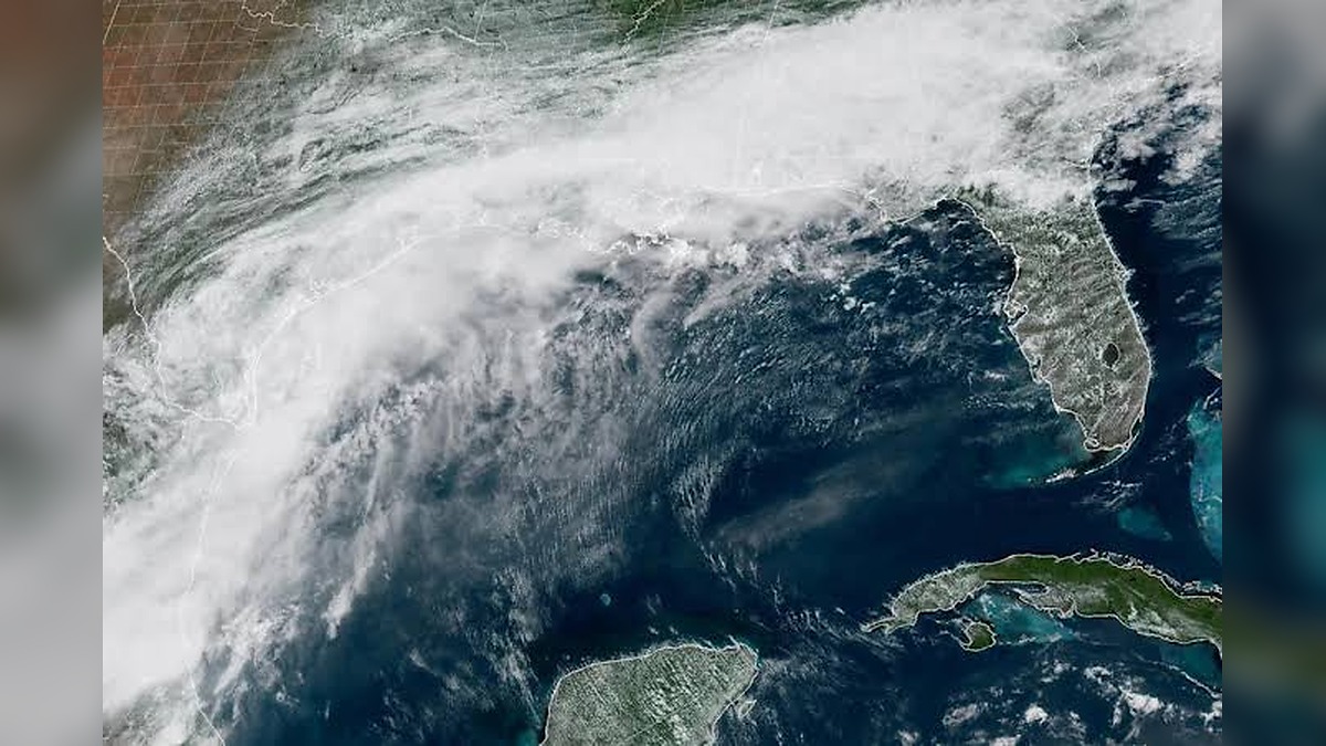
NHC Warns System Could Strengthen Into First Named Storm of 2026 Season
According to the NHC, the system is expected to move near or just off the northwestern Gulf Coast through midweek, with conditions favourable for further strengthening.
If it reaches sustained tropical storm status, it will be named Arthur—becoming the first named storm of the 2026 Atlantic hurricane season to threaten the US Gulf region.
Meteorologists say the system’s structure is still developing, but its rainfall potential and coastal impact risk are already prompting urgent preparations.
Watch Zone Spans Texas to Louisiana With Major Cities on Alert
The Tropical Storm Watch stretches from Sargent, Texas, to Morgan City, Louisiana, covering a broad and densely populated coastal corridor.
Communities including Galveston, Texas City, Freeport, Port Arthur, and Lake Charles are all within the alert zone, alongside multiple parishes across southwestern and south-central Louisiana.
The area includes low-lying coastal communities, bays, and inland waterways that are especially vulnerable to storm surge, flash flooding, and rapid water level rises.


Heavy Rainfall Forecast Raises Serious Flooding Concerns
Forecasters are warning of widespread rainfall totals between four and eight inches across parts of Texas, Louisiana, Mississippi, Alabama, and the western Florida Panhandle through Thursday.
In isolated locations, totals could reach as high as 12 inches, significantly increasing the risk of flash flooding in both urban and rural areas.
AccuWeather meteorologists have stressed that the potential for life-threatening flooding is significant, particularly as repeated rounds of heavy rain move across already saturated ground.
Tornado Risk and Coastal Impacts Add to Threat Level
In addition to flooding, meteorologists say isolated tornadoes cannot be ruled out from the upper Texas coast through Louisiana, Mississippi, Alabama, and parts of the Florida Panhandle.
While the system currently has winds of around 30 mph, forecasters at the National Weather Service say sustained tropical-storm-force winds are not expected at this stage.
However, gusty conditions could still impact coastal areas as the system approaches land.
Minor storm surge and coastal inundation are also possible, particularly along exposed sections of the Texas and Louisiana shoreline.
Officials Urge Residents to Prepare for Rapid Conditions Change
Emergency officials are urging residents across the watch area to closely follow updates, with conditions expected to evolve quickly as the system moves inland.
Authorities have emphasized the importance of preparedness, especially for communities prone to flooding, noting that evacuation orders or water rescues could become necessary depending on rainfall intensity.
Residents are being advised to secure property, review emergency plans, and remain alert for flood warnings as the situation develops.
Experts Warn Flood Threat Could Persist After Landfall
Although the system is expected to make landfall near the Texas–Louisiana border by Wednesday night, forecasters caution that its impact will extend well beyond the point of landfall.
Heavy rainfall is expected to continue spreading inland across the Southeast through Thursday, maintaining a prolonged flood risk across multiple states.
Officials warn that even after the system weakens, lingering moisture could continue to trigger dangerous flooding conditions, making this a multi-day weather threat for millions across the Gulf Coast region.
