
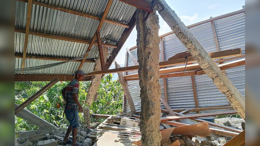
At least 40 people have been killed and dozens more injured after a powerful magnitude 7.7 earthquake struck off Indonesia’s Flores Island early Saturday, collapsing buildings, damaging infrastructure and forcing thousands of residents to flee their homes.
The earthquake struck at about 5:58 a.m. local time, sending residents into the streets as strong shaking was reported across parts of East Nusa Tenggara and surrounding regions.
Flores Island Bears the Brunt of the Destruction
The shallow earthquake occurred about 10 kilometres beneath the surface, with its epicentre roughly 68 kilometres from Ende on Flores Island.
Nagekeo, one of the areas closest to the epicentre, was among the hardest-hit locations. Authorities reported damage to homes, warehouses and government buildings, while roads became congested and power supplies were disrupted.
Around 2,000 residents were evacuated as emergency crews began assessing the scale of the destruction.
Buildings Collapse as Residents Run for Safety
Witnesses described scenes of panic as buildings shook violently and sections of structures collapsed.
Yohanes Babo, 55, said he was at a market in Nagekeo when the ground began moving. He said residents ran in different directions before evacuating toward higher ground.
Another resident, Nona, 51, said 13 members of her family were inside their home when the shaking began.
They all ran outside to escape the danger.
Hospitals Evacuated as Rescuers Search for Survivors
The earthquake severely disrupted medical services in parts of Flores, with hospitals forced to move patients outside as rescuers searched damaged buildings for people who might be trapped.
In Maumere, one of the island’s major towns, patients were treated in makeshift tents after medical facilities were damaged.
Similar emergency arrangements were established in Labuan Bajo, where healthcare workers treated patients outdoors following damage to medical buildings.
Authorities deployed Indonesian military and police personnel alongside rescue teams as emergency operations expanded across the affected areas.
Tsunami Warning Triggers Evacuations
The earthquake initially raised fears of a tsunami, prompting authorities to tell residents along vulnerable coastlines to move to higher ground.




Residents in Nagekeo reportedly noticed the sea retreating shortly after the earthquake, increasing fears that a larger wave could follow.
Tsunami waves of less than one metre were subsequently recorded in several locations. Indonesia’s meteorological agency had warned that waves between 0.5 and 3 metres could potentially affect parts of East Nusa Tenggara, South Sulawesi and West Nusa Tenggara.
The tsunami warning was lifted roughly three hours after the earthquake after the immediate threat subsided.
Aftershocks Add to the Fear
The main earthquake was followed by powerful aftershocks, including one measuring about magnitude 6.1.
Residents already displaced from damaged buildings were left facing continued uncertainty as emergency teams assessed unstable structures and searched for survivors.
Strong shaking was reported across East Nusa Tenggara, West Nusa Tenggara and parts of South Sulawesi, with some residents saying the tremors lasted for about a minute.
Damage Reported Across Key Communities
Footage from affected areas showed shattered windows, damaged buildings and people rushing into streets as structures shook.
At the Port of Maumere, parts of a heavily damaged building collapsed, while other facilities in the area also suffered significant damage.
A hospital near Ende was among the facilities where patients were moved outdoors. Reports also indicated that landslides had occurred in parts of the region, complicating access for rescue teams.
The damage and disrupted communications have made it difficult for authorities to establish the full extent of the disaster, particularly in more isolated communities.
A Second Earthquake Strikes on Sumatra
About 12 hours after the Flores earthquake, another strong earthquake struck on the Indonesian island of Sumatra, thousands of kilometres to the west.
The epicentre was reported northwest of Pematangsiantar in northern Sumatra, at a much greater depth of about 180 kilometres.
There were no immediate reports of major damage or casualties from the second earthquake, and seismologists said there was no tsunami threat associated with that event.
Indonesia’s History of Deadly Earthquakes
The latest disaster has again highlighted Indonesia’s vulnerability to major earthquakes because the country sits along the Pacific Ring of Fire, an area marked by extensive seismic and volcanic activity.
Flores was devastated by another major earthquake in 1992. That event generated a destructive tsunami and killed more than 2,000 people, with Maumere among the worst-affected communities. (Tsunami Programme UNESCO-IOC)
Indonesia has also experienced other catastrophic earthquakes and tsunamis, including the magnitude 9.1 earthquake off Sumatra in 2004, which caused enormous loss of life across the region.
Rescue Operation Continues
Emergency agencies are continuing to search damaged areas, evacuate residents and assess infrastructure as authorities work to determine the full impact of Saturday’s earthquake.
With communications and transportation disrupted in some locations, rescuers face difficulties reaching isolated communities.
Officials are also monitoring for further aftershocks and other hazards while displaced residents remain in temporary shelters.
The death toll and number of injured could change as rescue teams reach areas that have been difficult to access and complete their assessments.

