
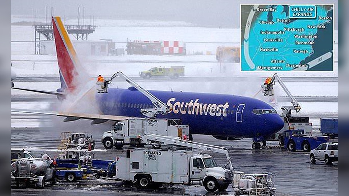
The first widespread snowstorm of the 2026-2027 winter season is expected to affect at least 19 US states, bringing a mixture of rain, sleet and snow across large parts of the country.
Air travel has already been disrupted, with several major airports experiencing temporary ground stops as heavy rain and thunderstorms move across the Northeast.
Newark Liberty International Airport, John F. Kennedy International Airport and LaGuardia Airport have reported flight delays of between two and four hours.
Boston Logan International Airport has also experienced disruptions, with arriving flights facing delays of up to 80 minutes.
A ground stop at the airport was extended until at least 6.30pm ET on Thursday.
At Least 19 States Prepare for Snow and Sleet
According to forecasts from AccuWeather, the weather system is expected to spread across the Northeast and parts of the Midwest from Thursday night.
The affected areas stretch from Maine to North Carolina along the East Coast, as well as from Michigan to Tennessee in the Midwest.
On Thursday, wet snow is forecast for northern parts of New Hampshire, Vermont, New York, Pennsylvania, Michigan and West Virginia.
By Friday, the wintry conditions are expected to expand into Massachusetts, Connecticut, Maine, Ohio, Indiana, Maryland, Virginia, Tennessee and North Carolina.
While major cities including New York, Boston, Philadelphia and Washington DC are expected to experience mostly rain on Thursday and Friday, snow could affect their northern suburbs and surrounding higher elevations.
Higher Elevations Could Receive Up to Six Inches of Snow
Meteorologists expect the heaviest snowfall to affect mountainous areas of West Virginia, Pennsylvania, northern New York and Michigan.
Accumulations of up to six inches are forecast for New York’s Adirondack Mountains, Vermont’s Green Mountains and Michigan’s Upper Peninsula.




AccuWeather’s worst-case scenario also suggests that isolated locations could receive as much as 12 inches of snow.
The system is expected to intensify as a low-pressure area moving into the Northeast receives additional support from another storm developing in the upper atmosphere.
AccuWeather senior meteorologist Alex Sosnowski said periods of rain and low clouds could disrupt flights from Thursday afternoon through Saturday morning, with the timing varying across different locations.
Wet Snow Could Damage Trees and Power Lines
Although the storm is not expected to develop into a major nor’easter, forecasters have warned that some areas could experience hazardous conditions.
The combination of rain and wet snow could create additional risks because heavy snow may cling to trees and infrastructure.
Sosnowski warned that the weight of the snow could break tree branches and damage power lines in affected communities.
The storm is not expected to produce the strong winds and widespread snowfall typically associated with a major nor’easter.
Meteorologists explained that the weather system will spend much of the week travelling over land rather than across the Atlantic Ocean, which usually provides additional energy for powerful winter storms.
However, the system could still behave like a nor’easter as it moves through New England over the weekend.
Snow Showers and Hazardous Roads Expected Over the Weekend
Additional snow showers are forecast to stretch from Maine to West Virginia between Saturday and Sunday morning.
The conditions could reduce visibility in some areas and create dangerous driving conditions across parts of the Northeast.
The storm is also expected to bring the coldest air of the 2026-2027 winter season so far to the eastern half of the United States.
Temperatures could fall between five and 15 degrees below normal for mid-November, with frost alerts also expected in parts of the southern United States.
El Niño Forecast Raises Questions About Winter Snowfall
The approaching storm comes as long-range forecasts from the National Weather Service indicate that the Northeast could experience an unusually warm winter because of El Niño.
However, AccuWeather meteorologists have warned that warmer seasonal temperatures do not necessarily rule out significant snowfall or powerful winter storms.
AccuWeather meteorologist Dan Pydynowski said a potentially historic El Niño could still create conditions favourable for powerful coastal storms, even if temperatures remain above historical averages.
He added that a single major storm could bring significant snowfall, coastal flooding and widespread travel disruptions, regardless of whether the overall winter season records below-average snowfall.
For now, forecasters expect the first major winter weather system of the season to continue affecting travel and weather conditions across the eastern United States through the weekend.
