Hawaii is bracing for the possibility of a major storm next week as Hurricane Kiko continues to gather force in the Pacific.
What started as a Category 2 system only days ago has now intensified to a Category 4 hurricane, with winds near 145 mph, and forecasters warn it could briefly hit Category 5 before weakening on its path toward the islands.
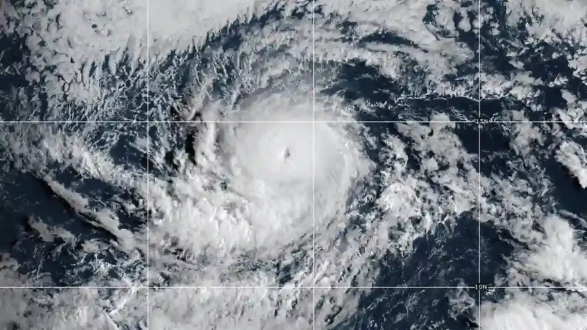
How Fast Kiko Is Strengthening
The National Hurricane Center confirmed Wednesday night that Kiko has been building strength rapidly.
In fact, the storm jumped from Category 2 to Category 3 almost overnight on September 2, and has now climbed even higher.
It currently sits about 1,600 miles east of Hawaii’s Big Island, moving west at roughly nine miles per hour.
At this stage, hurricane-force winds stretch 25 miles out from the eye, while tropical-storm-force winds extend up to 80 miles.
Meteorologists say the storm is feeding off warm waters and favorable wind conditions, which have allowed it to grow stronger.
Forecast: A Peak Before Weakening
Experts predict that while Kiko could briefly flirt with Category 5 intensity, it will not hold that level for long.
Cooler waters and stronger vertical wind shear are expected to weaken it by the weekend.
Current forecasts suggest that by the time it nears Hawaii, the storm will have dropped back down to Category 1, with winds closer to 75 mph.
Even so, forecasters caution that the threat is far from over.
A weaker hurricane—or even a tropical storm—could still bring heavy rainfall, dangerous surf, and damaging winds to Hawaii.
What Hawaii Could Experience
If Kiko continues on its projected path, landfall could happen as early as next Wednesday.
Rainfall is the main concern, with up to eight inches expected on the eastern side of the Big Island and around two inches across the rest of the state.
Flash flooding and mudslides are possible, especially in vulnerable areas.
So far, no official watches or warnings have been issued for Hawaii, and meteorologists stress that conditions can change quickly.
Remembering Hawaii’s Last Major Hurricane
Many residents still recall the devastation of Hurricane Iniki in 1992, which slammed into Hawaii as a Category 4 storm with winds also clocking in at 145 mph.
That storm killed six people, destroyed more than 1,400 homes, and caused around $3 billion in damage.
Kiko, for now, is hundreds of miles away, but it is already stirring unease given Hawaii’s storm history.
Another Storm Brewing in the Pacific
While Hawaii watches Kiko, another system—Hurricane Lorena—formed early Wednesday off the coast of Mexico.
With sustained winds near 85 mph, Lorena is expected to weaken into a tropical storm as it heads inland by Friday.
Still, Mexico’s Baja California and northwestern regions are on alert, with warnings in place for heavy rainfall, flash floods, and mudslides.
Some areas could see as much as 15 inches of rain, along with life-threatening rip currents generated by the storm.
A Busy Pacific Hurricane Season
Kiko is already the 11th named system in the eastern Pacific this year, and the season runs until the end of November.
Originally, the National Oceanic and Atmospheric Administration predicted a quieter season, but back-to-back storms like Kiko and Lorena suggest the Pacific still has plenty of energy left to unleash.