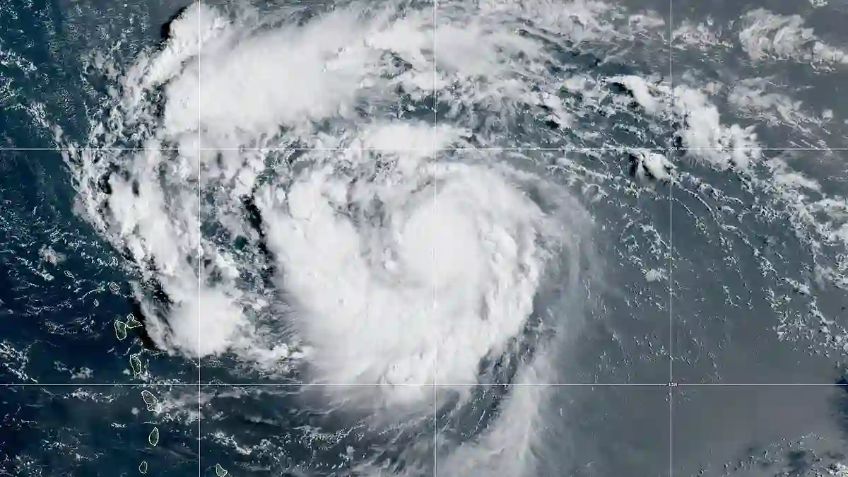
As summer storms churn over the Atlantic, residents and vacationers along the East Coast are on high alert. Storm Erin has officially escalated into the first hurricane of the 2025 season, signaling a potentially dangerous week ahead for millions.
Erin Strengthens Quickly Near the Leeward Islands
The National Hurricane Center (NHC) confirmed Friday morning that Erin had intensified into a hurricane.
Forecasts show it moving near or just north of the Leeward Islands by Saturday.
Meteorologists have been closely monitoring the system all week, noting that it is gaining strength rapidly and could become a Category 4 storm by Monday as it approaches Bermuda.
Dangerous Surf and Coastal Flooding Expected
Even if the storm stays offshore, experts warn that its effects could be felt far from its center.
Alex DaSilva, a lead hurricane specialist at AccuWeather, emphasized: “Do not underestimate the power of a major hurricane even passing by offshore.
These massive storms produce very rough surf and lethal rip currents that can impact beaches even hundreds of miles away.”
From the Carolinas up to New England, millions of Americans should prepare for coastal flooding, dangerous surf, and strong winds as Erin moves through the Atlantic
Projections Show a Northwest Turn Toward the US
Meteorologist Noah Bergen shared an eight-day projection showing Erin curving northwest toward Cape Hatteras, North Carolina, where hurricane-force gusts could strike. “
A recurve is still expected, but exactly how close it gets to the coast remains uncertain,” Bergen noted on social media.
These predictions rely heavily on the European Centre for Medium-Range Weather Forecasts (ECMWF) model, known for its high accuracy.
The model incorporates real-time data like sea surface temperatures, atmospheric pressure patterns, and satellite imagery, making it a critical tool for anticipating Erin’s path and intensity.
Rapid Intensification Could Bring Category 3 Winds This Weekend
Forecasters expect Erin to reach Category 3 strength by Saturday, with sustained winds exceeding 110 mph as it passes near Puerto Rico and the Dominican Republic.
Over the weekend, the storm is predicted to move northeast of Hispaniola, the Turks and Caicos, and the Bahamas.
By Monday, Erin’s winds could surpass 130 mph, elevating it to Category 4 for at least a day as it starts turning toward Bermuda.
DaSilva cautioned beachgoers: “Be vigilant if you’re heading to an East Coast beach next week. Only swim in areas with lifeguards on duty and heed rip current warnings.”
North Carolina and Virginia Face Early Impacts
The first US states likely to feel Erin’s impact are North Carolina and Virginia.
Beachfront homes could be at risk from strong surf, coastal flooding, and erosion as early as Monday or Tuesday.
Even as Erin weakens to Category 2 along the New England coast later in the week, heavy rain, gusty winds, and rough seas will still affect Maine, New Hampshire, and Massachusetts.
Massive Waves Pose Threat to Shipping
Offshore, Erin could generate enormous waves ranging from 50 to 100 feet, posing serious risks to cargo freighters and cruise ships.
For smaller vessels, waves of this magnitude could be life-threatening.
NOAA Predicts Above-Average Hurricane Season
The National Oceanic and Atmospheric Administration (NOAA) has forecast an above-average hurricane season for 2025, predicting up to 19 named storms, 10 hurricanes, and five major hurricanes affecting the US.
Last year’s season was especially deadly, claiming roughly 400 lives—the highest toll since 2005.
With Erin on the horizon, officials and residents alike are urged to stay alert, monitor forecasts closely, and prepare for a storm that could bring both widespread disruption and serious hazards along the Atlantic coast.
